
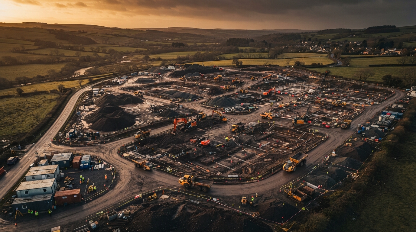
Drone Surveys For Construction & Property Across Lancashire
Cm-accuracy LiDAR topographic surveys, 3D roof plans for solar PV, and earthworks volumetric surveys - captured safely from the air, delivered in your CAD workflow.
Precision LiDAR & Topographic Surveys
Centimetre-accurate terrain and site data captured rapidly. We deliver survey-grade intelligence for complex landscapes and structures.
High-Density Point Clouds
Capture millions of data points for unparalleled site detail.
CAD-Ready Topo Plans
Seamlessly integrate 2D and 3D deliverables into your design software.
Hard-to-Reach Areas
Map dense vegetation, steep slopes, and hazardous terrain safely.
Construction Progress & Earthworks Tracking
Keep your project on track with regular aerial site intelligence, volume calculations, and as-built verification.
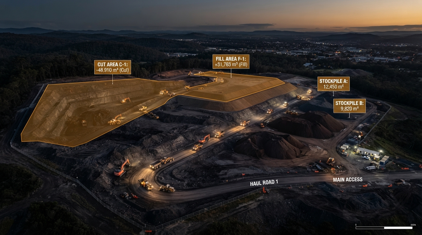
Cut/Fill Volume Calculations
Accurate stockpile measurements and earthmoving data.
As-Built vs Design
Overlay 3D site captures onto CAD/BIM models to verify progress.
Visual Progress Reporting
High-resolution orthomosaics to keep stakeholders informed.
Safe Property & Asset Inspections
Detailed visual and thermal data for building condition assessments, minimizing the need for scaffolding or rope access.
High-Res Imagery
Capture intricate details on roofs, facades, and hard-to-reach assets.
Defect Identification
Spot structural issues, water ingress, and wear with annotated reports.
Reduced Risk
Keep your team safely on the ground during initial assessments.
Interactive 3D Solutions
Navigate and inspect your assets remotely with immersive 3D digital twins.
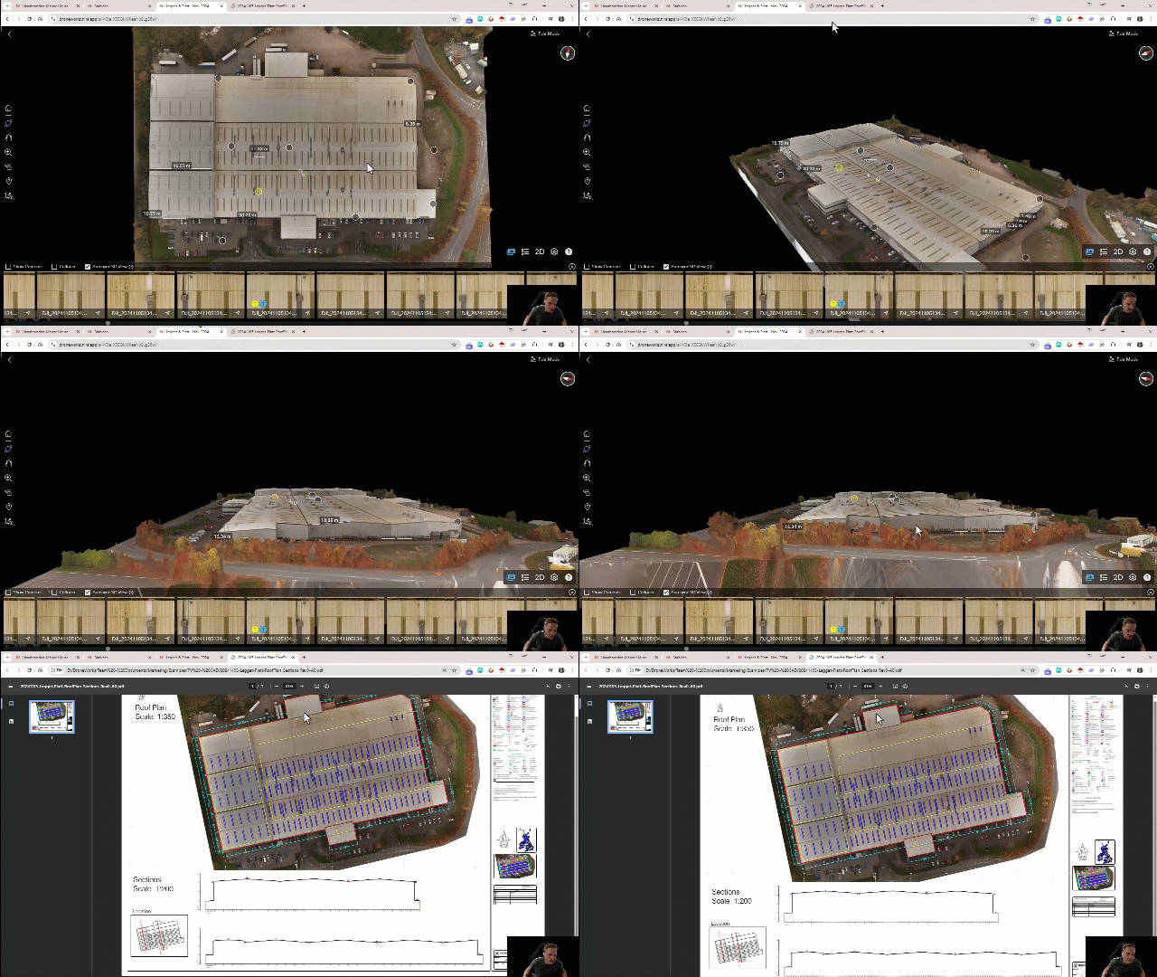
From Raw Data To Actionable Insight
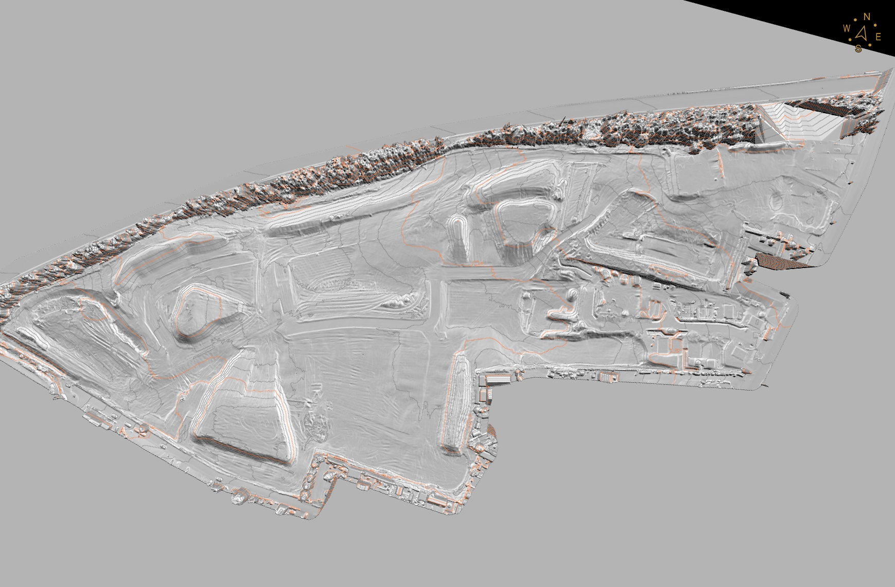
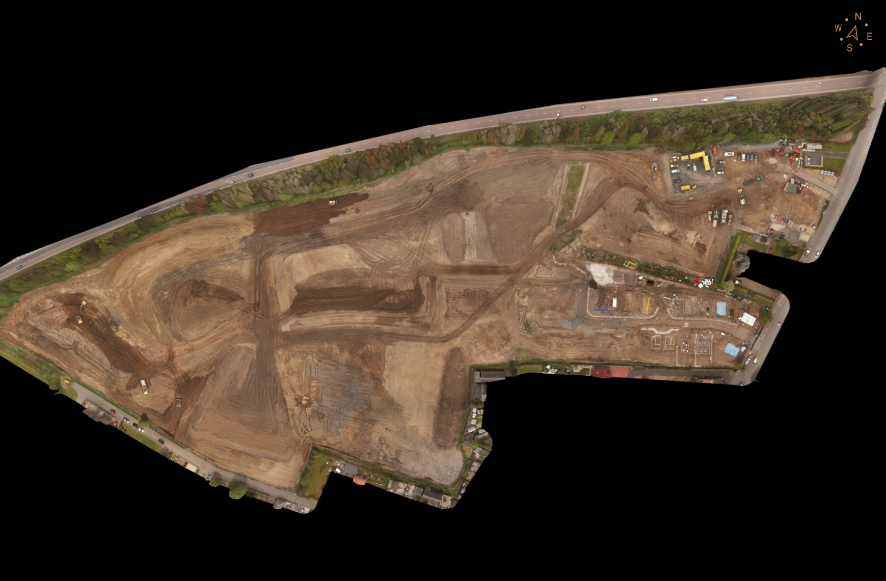
Drag the slider to see how we transform raw site captures into clear, precise 3D models and point clouds.
Three Core Survey Services
Every service is built around outcomes — accuracy, safety, and time saved on site. No jargon, no hobbyist kit.
LiDAR Topographic Surveys
Cm-accuracy land and topographic surveys for planning, groundworks and civil engineering.
- We capture dense LiDAR point clouds from the air to produce highly accurate topographic surveys - without the weeks of manual ground work.
- Cm accuracy is achievable on hard surfaces, giving you reliable DTM, contour and volume data ready for planning submissions and groundworks design.
- Vegetation penetration means we can survey wooded, overgrown or inaccessible terrain that traditional total stations struggle to reach.
3D Inspection & CAD Roof Plans for PV Projects
Drone-captured 3D models and CAD-ready roof plans for commercial buildings, solar PV installers and developers.
- We fly commercial rooftops to capture high-resolution 3D models and produce CAD-ready roof plans accurate to the cm - no scaffolding, no rope access, no risk.
- Solar PV designers get exact roof dimensions, pitch, obstacle positions and structural detail they need to plan panel layouts and generate accurate quotes.
- Our deliverables drop straight into your PV design workflow, cutting site visits and speeding up the quoting and installation process.
Earthworks & Stockpile Surveys
Volumetric measurement for cut/fill, stockpile monitoring and progress tracking on construction sites.
- We fly your site to capture dense aerial data and produce accurate volume calculations for cut/fill, stockpiles and earthworks progress - without shutting down the site.
- Regular surveys let you track material movement, verify contractor quantities and report progress with independently measured data.
- Our volumetric surveys are faster, safer and more cost-effective than traditional methods, and capture a complete visual record of site progress at the same time.
How Drones Are Revolutionising Topo Surveys
Traditional topographic surveys can take days of walking a site with GPS rovers. Drone LiDAR captures the same ground — and far more of it — in a single flight, delivering dense point clouds ready for your CAD or BIM workflow. Read our deep dive on how the technology is changing surveying for construction and civil engineering teams.
Faster, Safer, More Data — For Less
Traditional surveying means weeks on site, scaffolding for roof access, and surveyors working around live plant. Drone capture changes the economics.
Days, Not Weeks
Capture a full site in hours. Process and deliver in 3–5 working days.
Lower Cost On Most Sites
No scaffolding, no access equipment, fewer labour hours — especially on sites over 2 hectares.
Zero Site Risk
No working at height. No surveyors on active sites. RAMS produced for every job.
More Data, Not Less
Hundreds of points per m², full 3D models, orthomosaic imagery — not just spot measurements.
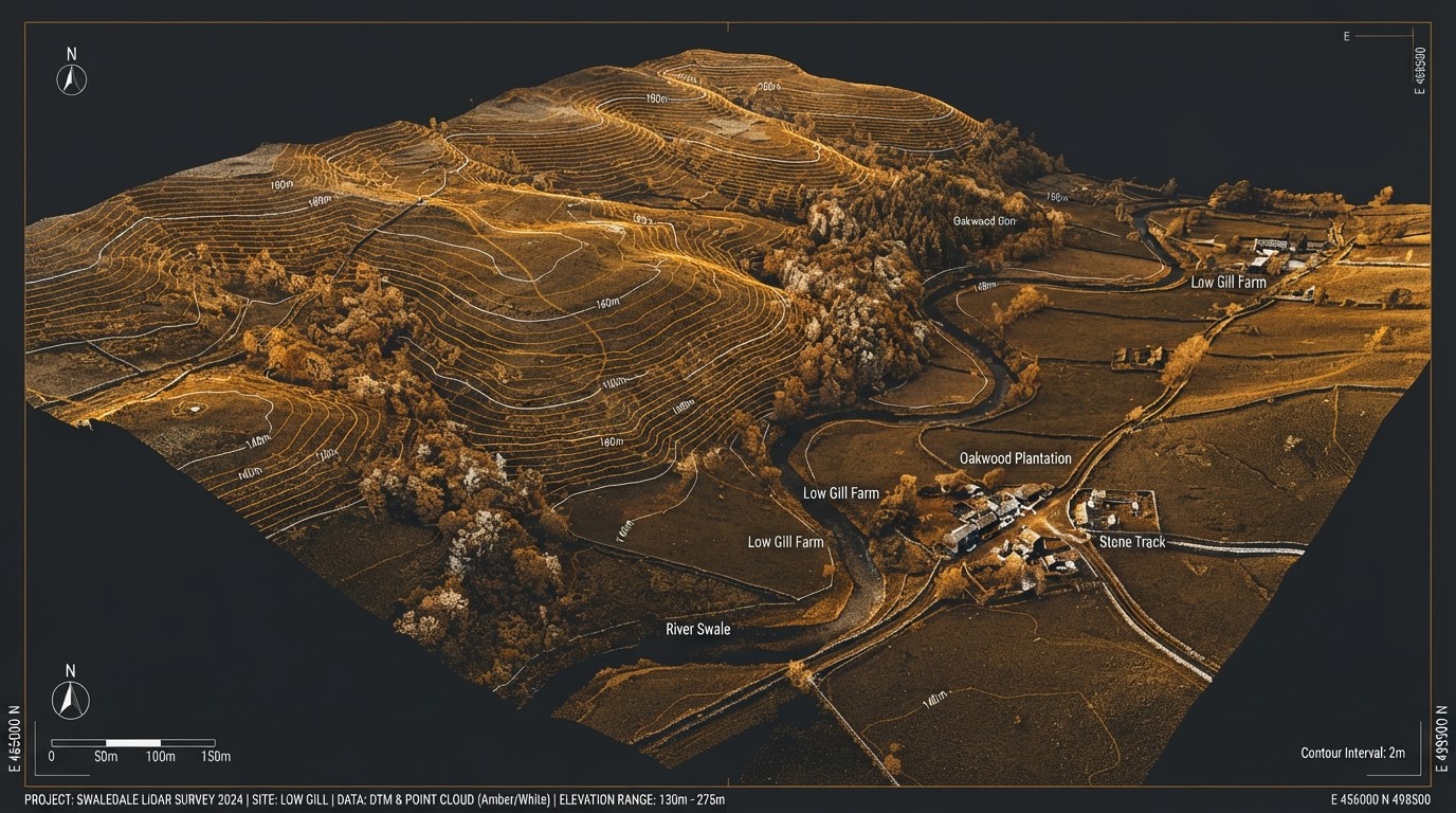
Cm accuracy · Up to 750 pts/m² · OSGB36 National Grid
Based In Preston, Serving All Of Lancashire
Core towns across Lancashire, with wider reach into Cumbria and Greater Manchester for larger and rural sites.
Preston
As our home hub, Preston is at the centre of our drone survey operations across Lancashire. From the city centre regeneration projects to the wider South Ribble development corridor, we provide rapid-response LiDAR, roof inspection and earthworks surveys throughout Preston and surrounding areas.
View area guideBlackpool
Blackpool's mix of coastal regeneration, commercial development and large-scale infrastructure projects makes it a key service area for our drone survey work. We deliver LiDAR topographic surveys, 3D roof inspections and earthworks monitoring across Blackpool and the Fylde coast.
View area guideChorley
Chorley's position at the crossroads of the M6, M61 and M65 motorways makes it a strategic location for development - and for our drone survey services. We provide LiDAR surveys, PV roof inspections and earthworks monitoring across Chorley and the surrounding borough.
View area guideLancaster
Lancaster's blend of historic urban fabric, university expansion and rural surroundings creates diverse survey requirements - from sensitive heritage site inspections to large-scale rural LiDAR. We deliver our full range of drone survey services across Lancaster and north Lancashire.
View area guideCommercial-Grade Kit, Qualified Pilots
Our Platform
DJI M350 RTK platform with Rock Robotic R3 Pro LiDAR
RTK positioning for cm accuracy, dense point cloud capture, and reliable performance in challenging conditions.
CAA Authorisations
- GVC (General Visual Certificate)
- PDRA01 Operational Authorisation
- A2 Certificate of Competency (A2CofC)
Insurance & Safety
- £5m Public Liability
- £2m Professional Indemnity
- RAMS produced for every job
- CSCS card holders
- PQS/SSIP accredited contractor
Always Use A Qualified, Insured Operator
Unlicensed drone operators can't produce admissible survey data, don't carry adequate insurance, and can't operate safely on construction sites. We hold full CAA authorisations, £5m liability cover, CSCS cards and SSIP accreditation — the credentials your site and insurers expect.
Veteran-owned company, established 2019.
Ready To Book A Survey?
Get a tailored quote for your site. Every project is scoped individually - we don't quote blind.