
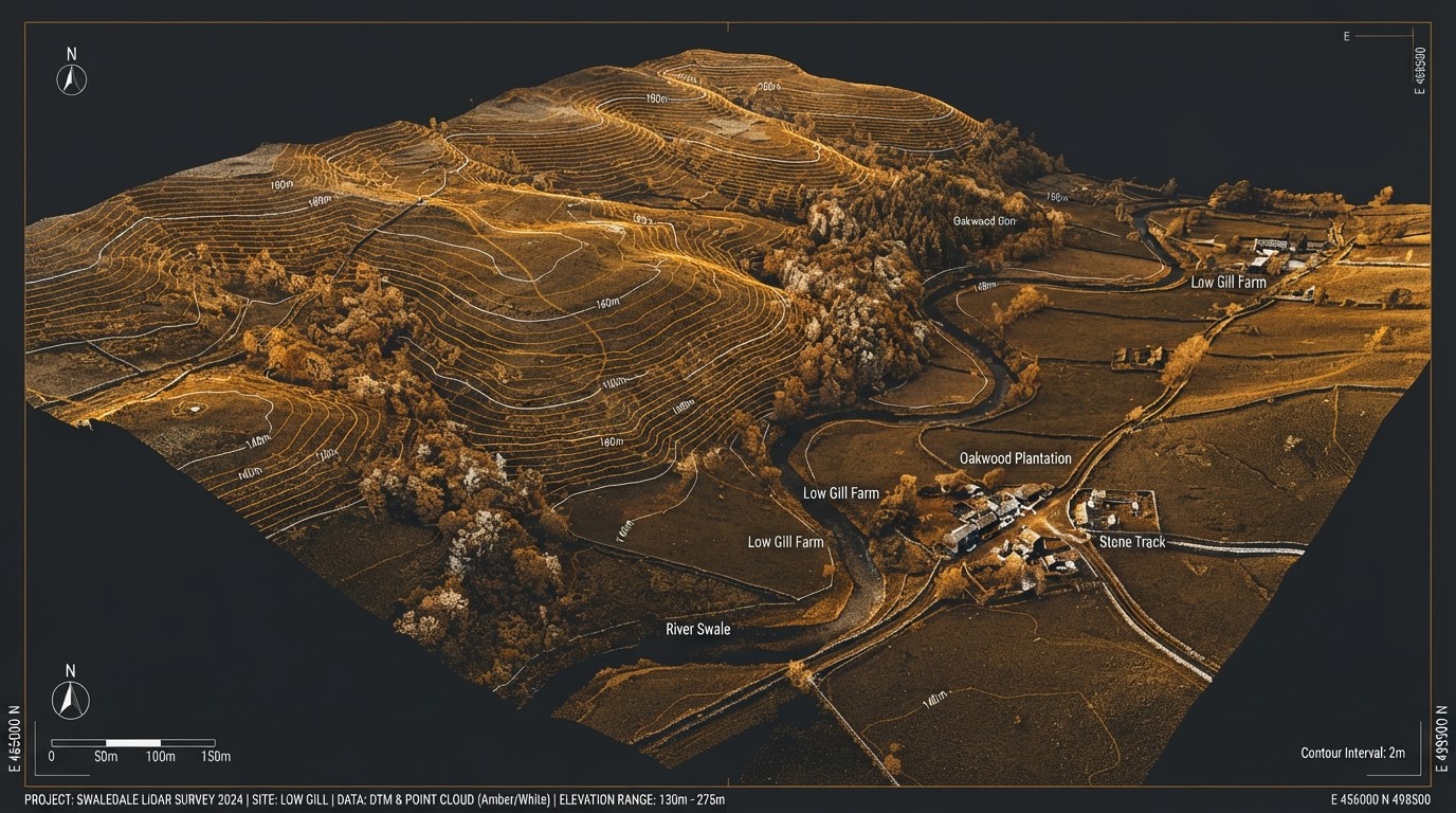
LiDAR Topographic Surveys
Cm-accuracy land and topographic surveys for planning, groundworks and civil engineering.
What This Service Delivers
We capture dense LiDAR point clouds from the air to produce highly accurate topographic surveys - without the weeks of manual ground work.
Cm accuracy is achievable on hard surfaces, giving you reliable DTM, contour and volume data ready for planning submissions and groundworks design.
Vegetation penetration means we can survey wooded, overgrown or inaccessible terrain that traditional total stations struggle to reach.
Who This Is For
Civil engineers, planning consultants, groundworks contractors, developers and land agents who need accurate topo data for planning, design or volume calculation.
At A Glance
Precision LiDAR & Topographic Surveys
Centimetre-accurate terrain and site data captured rapidly. We deliver survey-grade intelligence for complex landscapes and structures.
High-Density Point Clouds
Capture millions of data points for unparalleled site detail.
CAD-Ready Topo Plans
Seamlessly integrate 2D and 3D deliverables into your design software.
Hard-to-Reach Areas
Map dense vegetation, steep slopes, and hazardous terrain safely.
How We Deliver
From enquiry to delivery, a clear process built around your project needs.
Site Brief & Planning
We review your site boundary, access, required accuracy and deliverables, then plan flight lines and ground control.
Ground Control Points
We establish and survey GCPs across the site to tie the LiDAR data to your required coordinate system and datum.
LiDAR Capture
Our DJI M350 RTK with Rock R3 Pro LiDAR flies pre-planned lines, capturing dense point clouds with RTK positioning.
Data Processing
Point clouds are cleaned, classified and exported as DTM, contours, and your required CAD formats.
Delivery
You receive processed data in your preferred format - DWG, LAS/LAZ, XYZ, or full survey drawings.
What You Receive
- Classified 3D point cloud (LAS/LAZ)
- Digital Terrain Model (DTM)
- Contour lines at your specified interval
- 2D topographic survey drawing (DWG)
- Orthomosaic with ground control accuracy report
- Volume calculations (where required)
Equipment & Accuracy
| Specification | Detail |
|---|---|
| Accuracy | Cm on hard surfaces |
| Point Density | Up to 750 pts/m² |
| Platform | DJI M350 RTK |
| Sensor | Rock Robotic R3 Pro LiDAR |
| Output Formats | DWG, LAS/LAZ, XYZ, DXF |
| Coordinate Systems | OSGB36 / National Grid |
Why Drone Over Traditional Methods
A direct comparison for this service.
| Feature | Drone Survey | Traditional Method |
|---|---|---|
| Time On Site | Hours to days | Days to weeks |
| Vegetation Penetration | Yes - ground through canopy | No - requires clearing |
| Safety Risk | Minimal - no ground access needed | High - surveyors on active sites |
| Data Density | Hundreds of points per m² | Sparse - spot measurements only |
| Cost | Lower for sites over 2ha | Higher - more labour hours |
| Inaccessible Terrain | Easily surveyed | Difficult or impossible |
LiDAR Topographic Surveys Across Lancashire
Available in our core towns and wider North West coverage area.
LiDAR / Topographic Surveys - Your Questions Answered
Can't find what you're looking for? See all FAQs or contact us.
How Much Does a Drone LiDAR Survey Cost? UK Guide
Full cost breakdown on the DroneWorks blog.
Book A LiDAR / Topographic Surveys
From £1,200. Every site scoped individually - get a tailored quote today.